Tag: qgis.org
QField 3.6 “Gondwana”: Locking on greatness
Building on top of the last release which introduced background tracking, this development cycle focused on polishing functionalities and building on top of preexisting features. The variety of improvements is sure to make our diverse user base and community excited to upgrade to QField 3.6.
Main highlights
One of the most noticeable improvement in this version is the addition of “map preview rendering”. QField now renders partial map content immediately beyond the edge of the screen, offering a much nicer experience when panning around as well as zooming in and out. Long-time QGIS users will recognise the behaviour, and we’re delighted to bring this experience to the field
This upgrade was the foundation upon which we built the following enhancement: as of QField 3.6, using the “lock to position” mode now keeps your position at the very center of the screen while the canvas slips through smoothly. This greatly improves the usability of the function as your eyes never need to spend time locating the position within the screen: it’s dead center and it stays there!
Reminder, the “lock to position” mode is activated by clicking on the bottom-right positioning button, with the button’s background turning blue when the mode is activated.
The improvements did not stop there. Panning and zooming around used to drop users out of the lock mode immediately. While this had its upsides, it also meant that simple scale adjustments to try and view more of the map as it follows the position was not possible. With QField 3.6, the lock has been hardened. Moving the map around will temporarily disable the lock, with a visual countdown embedded within a toast message informs users of when the lock will return. An action button to terminate the lock is located within the toaster to permanently leave the mode.
Moving on to QFieldCloud, this cycle saw tons of improvements. To begin with, it is now possible to rely on shared datasets across multiple cloud projects. Known as localised data paths in QGIS, this functionality enables users to reduce storage usage by storing large datasets in QFieldCloud only once, serving multiple cloud projects, and also easing the maintenance of read-only datasets that require regular updates.
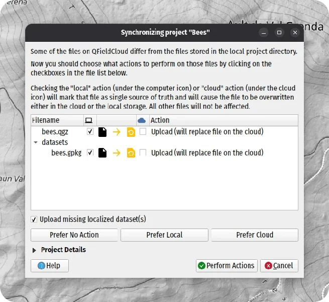
QFieldSync users will see a new checkbox when synchronising their projects, letting them upload shared datasets onto QFieldCloud.
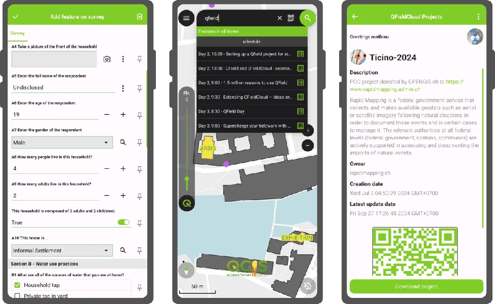
Furthermore, QField has introduced a new cloud project details view to provide additional details on QFieldCloud-hosted projects before downloading them to devices. The new view includes a cloud project thumbnail, more space for richer description text, including interactive hyperlinks, and author details, as well as creation and data update timestamps. Finally, the view offers a QR code, which allows users to scan it quickly and access cloud projects, provided they have the necessary access permission. Distributing a public project has never been easier!
Beyond that, tons more has made its way into QField, including map layer notes viewable through a legend badge in the side dashboard, support for feature identification on online raster layers on compatible WMS and ArcGIS REST servers, atlas printing of a relationship’s child feature directly within the parent feature form, and much more. There’s something for everybody out there.
Focus on feature form polishing
This new version of QField coincides with the release of XLSForm Converter, a new QGIS plugin created by OPENGIS.ch’s very own ninjas. As its title implies, the plugin converts an XLSForm spreadsheet file (.xls, .xlsx, .ods) into a full-fledged QGIS project ready to be used in QField with a pre-configured survey layer matching the content of the provided XLSForm.
This was a golden opportunity to focus on polishing QField’s feature form. As a result, advanced functionalities such as data-driven editable flag and label attribute properties are now supported. In addition, tons of paper-cut bugs, visual inconsistencies, and UX shortcomings have been addressed. Our favourite one might just be the ability to drag the feature addition drawer’s header up and down to toggle its full-screen state 
FOSSGIS 2025 – What a Week!
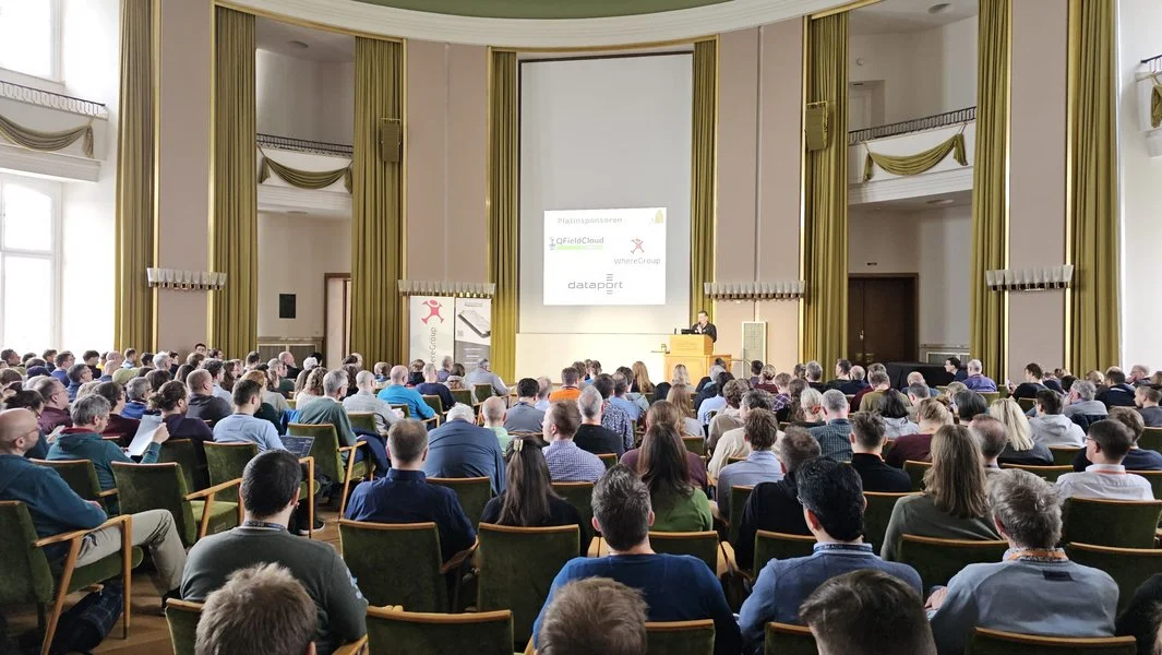
As long time sponsors of FOSSGIS, we stepped up the game this year and became Platinum Sponsors for FOSSGIS 2025. We are proud to be part of a thriving open-source GIS community and to contribute to such a great conference. Here’s a recap of everything we were involved in:
 Talks & Presentations
 QField: New Strategy and Application Potential
Berit and Marco presented how QField, with over 1 million downloads and 350,000 active users, is now recognized as Digital Public Good aligned with the UN Sustainable Development Goals. Marco also shared the vision and mission behind QField’s development — highlighting our commitment to empowering field teams across the globe with open, user-friendly tools for data collection.
Real-world stories illustrated how QField helps bridge data gaps to support informed, sustainable decision-making. View talk
 QField in Practice: Fieldwork Made Easy
Berit and Michael led an interactive workshop demonstrating how to develop a QField project from scratch. The goal was for each participant to create and sync their own field study project using QFieldCloud, focused on collecting data on flowering plants in the picturesque “Schlussgarten.” View session
 When Web Meets Desktop
Matthias demonstrated how Django can be used to build consumable geodata layers via OGC API – Features endpoints. His talk covered how to use Python and Django ORM to elegantly define data models and business logic, offering an alternative to complex database logic. View talk
 Extending QFieldCloud – Ideas and Practical Examples
Michael showed how QFieldCloud can be extended with Django apps, sharing practical implementations such as automated project generation and integration of remote sensing workflows. View talk
 QField Plugins – Examples and Possibilities
In a lightning talk, Michael introduced useful QField plugins, explained how to install and use them, and explored how they can enhance your mobile GIS workflows. View talk
 Hands-on qgis-js: Building Interactive QGIS-Based Web Maps
In this practical workshop, Michael guided participants through using qgis-js, an exciting new project that brings QGIS functionality directly into the browser. View session
 QGIS AMA Expert Session
Matthias and Marco hosted a live Q&A session where attendees could ask everything about QGIS development, best practices, organisation and real-world applications.
 At the Booth
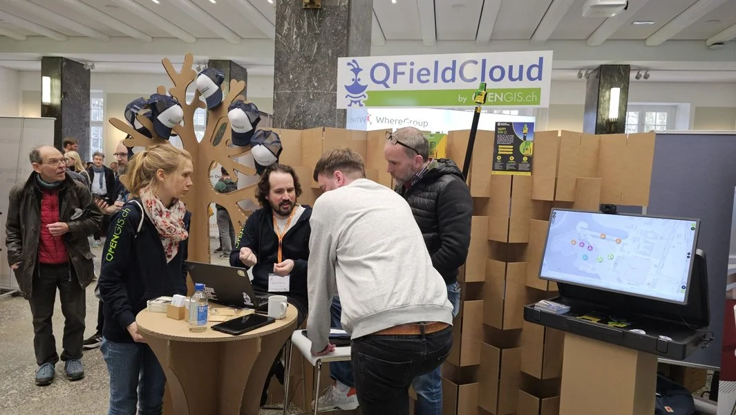
Our QField booth was buzzing with activity all week – from plugin demos and project showcases to deep dives into QFieldCloud and field mapping workflows. We had great conversations, received valuable feedback, and met many enthusiastic users.
 Supporting Open Source
We were proud to be Platinum Sponsors of FOSSGIS 2025. Supporting open-source events like this is essential for fostering innovation, collaboration, and community-driven growth in the GIS world.
 Looking Ahead
Thank you to the organisers, speakers, and everyone who joined us in Münster. We left the event full of ideas, motivation, and appreciation for this community – and we’re already looking forward to the next FOSSGIS!
#QField #QFieldCloud #FOSSGIS2025 #OpenSourceGIS #QGIS #SupportOpenSource
QGIS Swiss Locator 3.0 brings elevation profiles and vector tiles
Swiss elevation profiles
Get high-precision elevation profiles in QGIS right from Swisstopo’s official profile service, based on swissALTI3D data!
Thanks to this integration, you can take advantage of existing QGIS features, such as exporting 2d/3d features or distance/elevation tables, as well as displaying profiles directly in QGIS layouts.
Tip: Swiss elevation profiles will be available as long as the Swiss Locator plugin is installed and active. Should you need to turn Swiss elevation profiles off to create other profiles with your own data, go to the Plugin manager and deactivate the plugin in the meantime.
For developers
We’re paving the way for adding custom elevation profiles to QGIS. For that, we’ve added a QGIS profile source registry so that plugin developers can register their own profile sources (e.g., based on profile web services, just like we did here) and make them available for QGIS end users. The registry is available from QGIS 3.38. It’s your turn! 
Thanks to the QGIS user group Switzerland for funding this feature! 
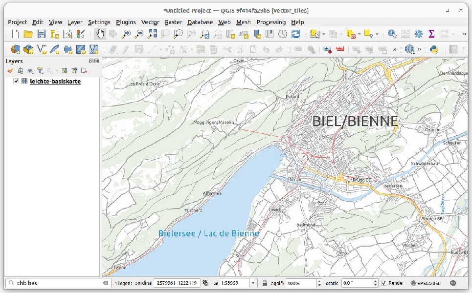
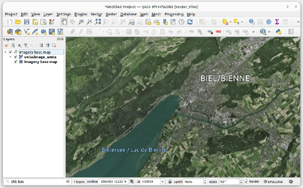
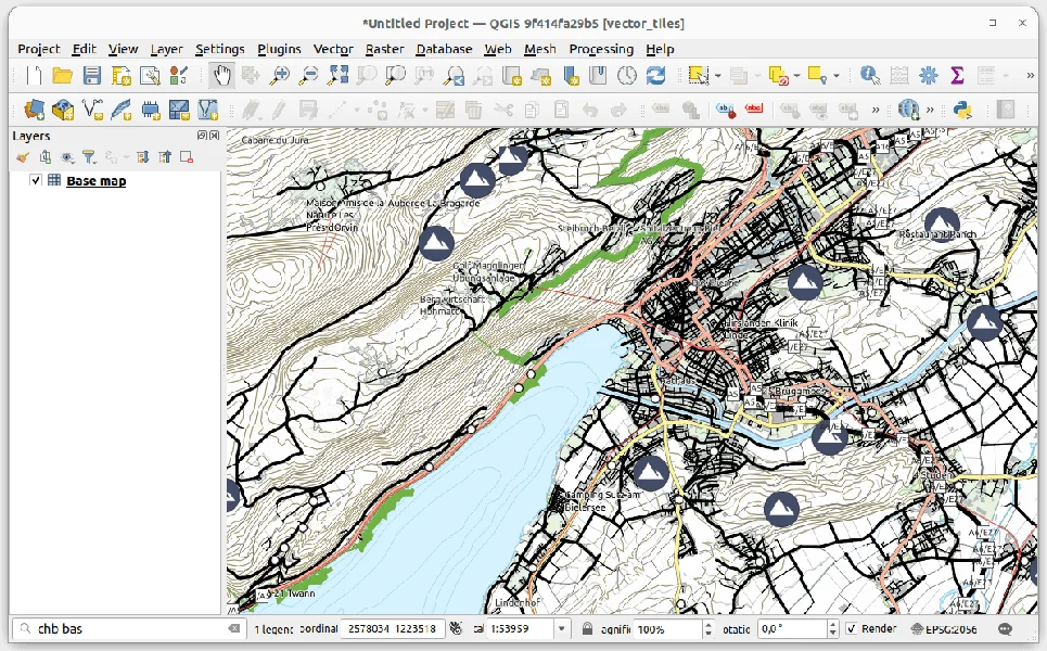
Swiss vector tiles base maps
Loading Swiss vector tiles is now easier than ever. Just go to the locator bar, type the prefix “chb” (add a white space after that) and you’ll get a list of available and already styled Swiss vector tiles layers. Some of them will even load grouped auxiliary imagery for reference.
Vector tiles will be loaded at the bottom of the QGIS layer tree as base maps, so you will see all your data on top of them.
Vector tiles are optimized for local caching and scale-independent rendering. This also makes it a perfect fit for adding it to your QField project.
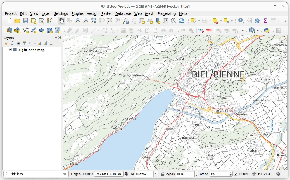
There are a couple of different vector tile sets available:
leichte-basiskarte
Light base map
Similar to the leichte-basiskarte layer, but using an older version of the data source and adjusted styles.
leichte-basiskarte-imagery (with WMTS sublayer)
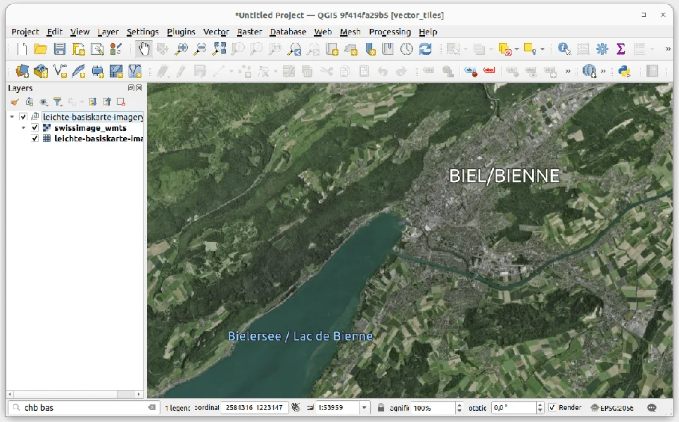
Imagery base map (with WMTS sublayer)
This layer is similar to the leichte-basiskarte-imagery layer, but it uses an older version of the data source and adjusted styles.
Base map
See the official services documentation for details on data sources and styles.
Fixes
Thanks to your feedback, we’ve also fixed some issues. Don’t hesitate to reach out to us at GitHub if you’d like to suggest or report something related to the Swiss Locator plugin.
Happy (and now more powerful) mapping! 

QGIS.ch user-day 2024 – A biased review by uber-happy committers
During the pandemic, people noticed how well they could work remotely, how productive meetings via video call could be, and how well webinars worked. At OPENGIS.ch, this wasn’t news because we have always been 100% remote. However, we missed the unplanned, in-person interactions that occur during meetups with a  or
or  . That’s why we’re very pleased that last week we could join the Swiss QGIS user day for the second time after the pandemic.
OPENGIS.ch has been invested in QGIS since its inception in 2014, actually even before; our CEO Marco started working with QGIS 0.6 in 2004 and our CTO Matthias with version 1.7 in 2012. Since 2019, we have also been the company with the most core committers. We can definitely say that OPENGIS.ch has been one of the main driving forces behind the large adoption of QGIS in Switzerland and worldwide.
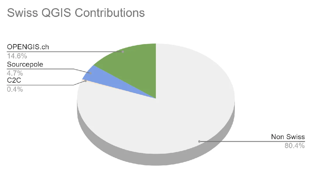
Looking at the work done in the QGIS code we’re by far the most prolific company in Switzerland and second worldwide only to North Road Consulting. On top of it, we were the first – and still only one of two- companies to sustain QGIS.org at a Large level since 2021.
This makes us very proud and it is why we’re even happier to see how much that is happening around QGIS in Switzerland aligns with the visions and goals we set out to reach years ago.
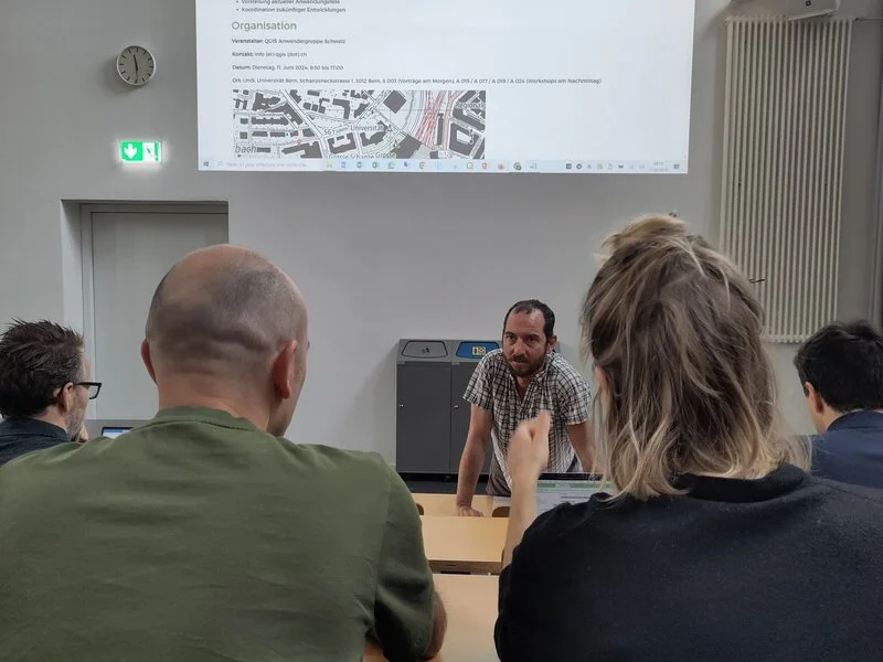
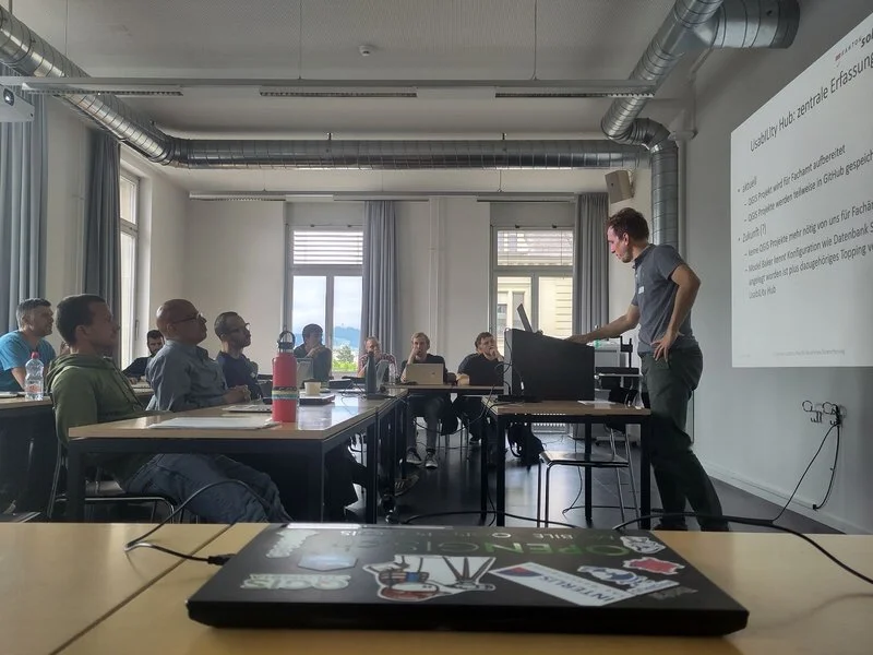
The morning started with a presentation by our CTO Matthias “What’s new in QGIS” featuring plenty of work sponsored by the Anwendergruppe CH.
DXF Improvements, the release of SwissLocator 3.0 with swissalti3d and vector tiles integration, and an update on the advances towards solid curve handling in QGIS, a prerequisite for properly handling AV data in Switzerland, were only some of the many noteworthy points he touched.
The highlight of Matthias’ presentation was the better OGC API Features support in QGIS, which was also highlighted in a subsequent talk about Kablo, showing how the next generation of industry solutions (Fachschalen) will be implemented.
Slides: Neues aus der QGIS Welt - QGIS Anwendertag 2024Following was a short presentation on the project DMAV, Christoph Lauber introduced a project that aims to implement an industry solution for official cadastral surveying with QGIS.
Adrian Wicki of the Federal Office for the Environment (FOEN) and Isabel presented how OPENGIS.ch and the partners Puzzle and Zeilenwerk help the FOEN with the SAM project with assess the hazards of flood, forest fire, or landslides, and warn authorities and the population. With an agile project organisation, the complex project succeeds in fulfilling requirements by applying user-centred development concepts. QGIS is used for visualizing and analyzing data and helping forecasters gain insights into the current situation.
Slides: BAFU_SAMAndreas Neumann from ETH Zurich and Michael presented the qgis-js project. QGIS-js is an effort to port QGIS core to WebAssembly so that it can be run in a web browser. Although still in the early experimentation phase, this project has great potential to leverage interesting new use cases that weren’t even thinkable before.
Slides: https://boardend.github.io/qgis-js-demo/ Olivier Monod from the City of Yverdon presented Kablo, an electricity management proof of concept of the next generation implementation for industry solutions developed in collaboration with OPENGIS.ch.
By applying a middleware based on OGC API Features and Django, Kablo shows how common limitations of current industry solutions (like permission management and atomic operations) can be overcome and how the future brings desktop and web closer together.
Slides: kablo-qgis-user-daysObviously, it wasn’t just OPENGIS.ch. Sandro Mani from Sourcepole presented the latest and greatest improvements on QWC2, like street view integration and cool QGIS features brought to a beautiful web gis. Andreas Schmid from Kt. Solothurn presented how cool cloud-optimized geotiff (COG) is and what challenges come with it. Interested in the topic? Read more in our report about cloud optimized formats. Mattia Panduri from Canton Ticino explained how they used QGIS to harmonise the cantonal building datasets and Timothée Produit from IG Group SA presented how pic2map helps bring photos to maps.
To round up the morning, Nyall Dawson from North Road Consulting did a live session around the world to show the latest developments around elevation filtering in QGIS.
In the afternoon, workshops followed. Claas Leiner led a QGIS expression one while Matthias and Michael showed how to leverage QGIS processing for building geospatial data processing workflows.
The first QGIS model baker user meeting took place in the third room. The participants discussed this fantastic tool we developed to make INTERLIS work smarter and more productive.
It was a very rich and constructive QGIS user day. We came home with plenty of new ideas and a sense of fulfilment, seeing how great the community we observed and helped grow has become.
A big thanks go to the organisers and everyone involved in making such a great event happen. Only the beer in the sunshine was literally watered by the rain. Nevertheless, there were exciting discussions in the station bistro or in the restaurant coaches on the way home.
See you next time and keep contributing 